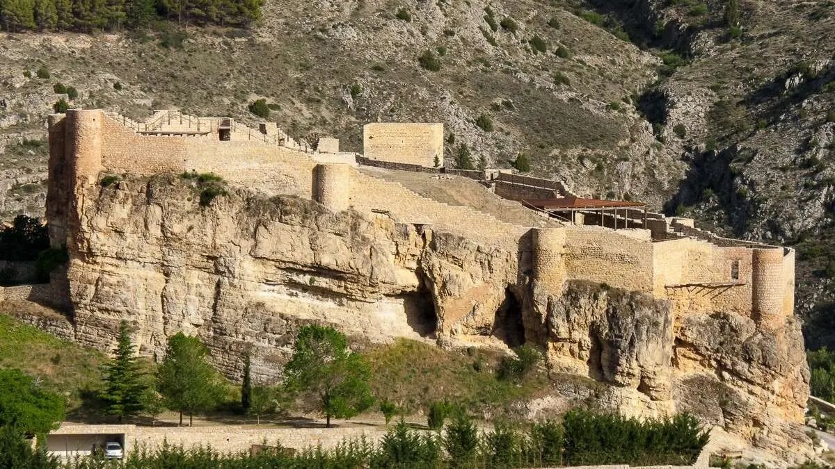

Mountain ranges, depressions, plateaus and rivers can all be found here—impressive landscapes that reveal something new on every visit and provide the ideal setting for each hiking route.
It is also worth noting that the routes vary in difficulty and length. Some can be completed with children, making it possible to adapt to the group’s physical abilities and the time available.
In this article, we review the 10 best hiking routes in Teruel. Shall we get started?
Parrizal de Beceite Route
The Parrizal de Beceite route is one of the most popular hiking trails in Teruel.
It is one of the natural areas in the Matarraña region, reached by walking through the narrow canyon formed by the Matarraña River, where swimming is not permitted. The 8-kilometre route can be completed in under three hours, making it a moderately difficult hike that can be enjoyed at a leisurely pace.
It begins at the Parrissal car park and, after passing through a botanical garden, hikers must cross the walkways anchored to the canyon walls, which lead to the waterfall. The return journey follows the same route, while those looking to cool off can save their swim for Beceite’s natural pool or the pools reached free of charge via Chiringuito Parrizal, which also allows pets.
Pasarelas Route in Teruel
The Pasarelas Route in Teruel was created in 2023
The Pasarelas Route in Teruel was created in April 2023. It is a riverside trail along the banks of the Guadalope River, a path created to connect Aliaga and Montoro de Mezquita.
Today, it is one of the most impressive routes in the Maestrazgo and Cuencas Mineras regions.
High above the river, the route features walkways, suspension bridges and privileged views of gorges and valleys. The trail begins in the hamlet of Santa Bárbara and follows the river into the spectacular Guadalope gorges, including Hoz Mala, Boca del Infierno and Valloré.
Over 21 kilometres, hikers reach the mouth of the Pitarque River, where the route connects with the GR 8.1 between Ejulve and Villarluengo.
The trail also reaches the reservoir of the former Aliaga Thermal Power Station. This is one of the most impressive stops along the route.
The route is moderately difficult, as a good level of fitness is advisable to tackle some of its descents.
The Guadalope River walkways are a very wild and little-explored area. Compared with other walkway routes in Aragón, this one is much longer and features stunning landscapes with unique environmental and geological value.
La Hoz Ravine Circular Route
The La Hoz Ravine route begins in Calomarde
The La Hoz Ravine route stands out as a unique place to get close to nature and enjoy it in all its splendour.
The path is surrounded by rocky walls and crystal-clear waters that seem to have come straight out of a fairy tale. Many people choose it because it is a peaceful route. In fact, its three hours pass much more quickly than expected thanks to the beauty of the scenery.
The La Hoz Ravine route begins in Calomarde, and much of the path is lined with metal walkways that cross the Blanco River, forming a circular route.
For the return journey, hikers must follow the same trail along the Blanco River. On both the outward and return legs, they can enjoy the Sierra de Albarracín in all its splendour, on an easy route suitable for families.
The highlights of this route include:
Moricacho de la Hoz. A massive rock rising above the Blanco River. Cañón de los Arcos. A narrow area near Fuente del Berro, which can be viewed and enjoyed up close. Fuente del Berro picnic area. Located near Poveda Bridge, it is a special place to spend time with the family.
El Cuervo–Tormón Route
The Ebrón Narrows Route features different natural pools, crossings over the river and sections with walkways
The El Cuervo–Tormón route begins in El Cuervo and follows the entire bank of the Ebrón River.
Some sections of this route run along walkways and areas equipped with ropes, and almost the entire trail is marked with red stakes to help hikers follow the route.
It is important to note that the route is not recommended for young children because of its length, nor is it suitable for cycling.
As for the landscape, it is a river canyon with two clearly distinct types of terrain: one alongside the river and another more rugged and steep as the trail climbs towards Tormón.
Terraces used for cultivation and fruit trees can be seen along the route. As the trail enters the ravine, the vegetation becomes more rugged, with species such as junipers, savins and holm oaks.
Near the picnic area, a short detour leads to viewpoints overlooking the Ebrón River.
Ojos de Cabriel Route
The Ojos de Cabriel route begins in El Vallecillo
On the Ojos de Cabriel route, visitors can see pure water springing from the ground through two natural openings in the earth’s bed. One of its peculiarities is that the water reaches the surface crystal clear and takes on the colours of the surrounding vegetation. This is where its name comes from, as the springs can appear turquoise, green, bluish or the colour of the earth.
The route begins in the village of El Vallecillo. From there to the Cabriel Viewpoint, follow the eastbound route along the dirt track. Once at the viewpoint, visitors can admire views of pine trees and other species.
The route then continues northeast towards the Ojos del Cabriel. There are some descents, but none are particularly difficult, and the Ojos del Cabriel are 500 metres away.
These natural springs of pure, crystal-clear water rising from underground are a truly unmatched attraction. There are at least two, located very close to the bank of the Cabriel River, into which their waters flow. Visitors can watch the water emerge from deep within the earth.
From the Ojos del Cabriel to the Ojos del Cabriel Waterfall, continue east along the same route. After walking approximately 500 metres, hikers reach the beautiful waterfall.
At this point, the Cabriel River plunges several metres. If you visit during periods of high water flow, you will see an impressive aquatic spectacle. The return journey follows the same path.
The outward leg is approximately 2.5 kilometres long, making the complete route nearly 5 kilometres. It takes around two hours to complete, including stops to admire the natural wonders along the way.
Las Tajadas Route
Las Tajadas de Bezas is known for its rock formations. Photo: Turismo de Aragón
In this unusual landscape, which could seem to belong to another planet, the main attraction of the Las Tajadas de Bezas route is its reddish rodeno rock formations, with crags among pine trees and scrub, creating canyons and labyrinthine trails and passageways.
The arrangement of the rocks in vertical formations resembling walls gave this picturesque and fascinating place its name. The landscape includes the Rodeno Pine Forests, which form part of the route, as well as prehistoric rock paintings belonging to Hispanic Levantine art.
The starting point of this easy circular route, which can be completed by families, is the village of Bezas, along the Las Minas track running through cultivated fields.
The trail passes a couple of abandoned structures at the beginning of the route, and the first rock paintings can already be seen just a few metres from the path. Information about them is signposted, with panels to guide hikers.
Continue along the path parallel to the stream until reaching an intersection near the burned-wood sculptures of Bezarte. Then climb towards the Peñahierro Viewpoint.
Some sections of the trail run between rodeno rocks, leading to a second group of rock paintings. The viewpoint is located on top of rocks that require a short climb. It is even possible to see snow on Javalambre. The views are beautiful.
The return journey follows the marked trail until reaching a fork, where hikers take the path on the right leading back to the village of Bezas.
Masmut Rocks Circular Route in Peñarroya
The Masmut Rocks circular route in Peñarroya circles this imposing rock formation
The Masmut Rocks circular route in Peñarroya circles this imposing rock formation, which is more than 100 metres high and 800 metres wide and is known as “Les Roques del Masmut”.
It is a massive reddish limestone formation that gives the town its name. The name most likely comes from “masmuda”, a Berber tribe that may have occupied the area during the Arab occupation.
The technical name of this route is PR-TE-157. It is between 16 and 18 kilometres long and takes an estimated six hours, so hikers should be well prepared.
The route begins in the village of Peñarroya de Tastavins, at a place known as the San Miguel pond. From there, the trail descends several metres towards the Virgen Ravine. Before long, the enormous Masmut formation can be seen on the right.
As the trail heads towards Canaleta Bridge, beneath which the Prados River flows, hikers can enjoy this simple and beautiful section. Further on, signs indicate the path leading to the base of Masmut. By this point, the route is more than 5 kilometres long.
Once at the base of the cliffs, hikers can climb them, but they must do so carefully. The effort is worthwhile because the view from the top is beautiful, contrasting the blue sky with the green vegetation surrounding the giant and the reddish tones of the rock.
The descent from the rocks follows the same route as the climb. Once back down, the path continues towards the remains of the Borlas farmhouse. The final descents require caution because some sections are slippery.
By the time hikers reach the Vuelta Ravine, they will have covered 13 kilometres. With little left to complete the circular route, they reach the San Miguel pond and then Peñarroya de Tastavins.
Ascent of Peñarroya Peak
The ascent of Peñarroya Peak is a real challenge for hikers. At more than 2,000 metres, it is the highest mountain in Teruel, and the climb is reserved for experienced mountaineers, especially when there is snow, as snowshoes would be necessary.
Those who take on the challenge will cover a total of 20.5 kilometres and spend almost seven hours walking.
To complete the route, follow the directions for stage 12 of the GR-8, which begins at the last houses in Alcalá de la Selva.
After passing cultivated fields and several rural houses, hikers reach a recreational area and the famous La Chaparrilla spring. From here, the ascent begins northwards towards the summit. The return journey follows the same route.
Guadalaviar Nature Trail
Guadalaviar Nature Trail. Photo: Turismo Aragón
The Guadalaviar Nature Trail is a route that will undoubtedly bring peace to everyone who takes on the challenge of completing it.
It follows a river channel that begins at Muela de San Juan, in the Montes Universales, and reaches the Mediterranean Sea approximately 286 kilometres later. But do not worry—the route itself is somewhat shorter.
The trail begins on the outskirts of the San Blas district in the city of Teruel and ends at the Arquillo Reservoir.
It is a linear route of around 3 kilometres each way, which can be combined with a 1.6-kilometre circular section along a zigzag path offering spectacular views of Teruel.
After a few metres, hikers reach the Señorita spring. On returning to the main route, the trail follows the left side of the river channel against the current.
The path is shaded by trees growing on both sides of the river. Hawthorns, poplars, willows and ash trees provide cover.
There are then two viewpoints: Balsón Grande and El Chopo. After 1,200 metres, hikers reach a fork leading up to the high plateau, where they can see Teruel, although it is best to take this path on the return journey.
Continuing along the route, the narrowest section leads to the site of the former Arquillo Dam. The current Arquillo Reservoir lies above the dam.
From this point, the return journey follows the same route, or hikers can continue towards the aforementioned high plateau.
Rambla de Barrachina
The Barrachina route is known as the Far West
Rambla de Barrachina is another hiking route in Teruel located close to the capital. It is known as the Teruel Far West because of its similarity to the landscapes of Hollywood’s Old West.
This canyon in Teruel’s Far West is approximately 12 kilometres long, with little elevation gain, and can be completed in around four hours.
The route begins in the Villaespesa plain and enters the ravine, with its semi-desert vegetation. After passing the Civil War trenches, hikers reach Muela de Teruel, the highest point on the route.
Before the descent, the Valdeciervos viewpoint offers another impressive and relaxing panorama.
Source of the Pitarque River Route
The source is located in the village of Fortanete. Photo: Turismo de Aragón
The Source of the Pitarque River route is located in one of Teruel’s most attractive regions, the Maestrazgo.
The area is home to a cultural park named after the place where the Pitarque River rises.
The source is located in the village of Fortanete, which can be seen after completing the approximately 8-kilometre route in under three hours.
The trail begins in Pitarque and is well signposted, making the route much easier to follow. It passes the hermitage and the hydroelectric plant before reaching the riverbank.
Continue along the riverbed between pools and waterfalls to reach the source of the Pitarque River. The return journey follows the same path.